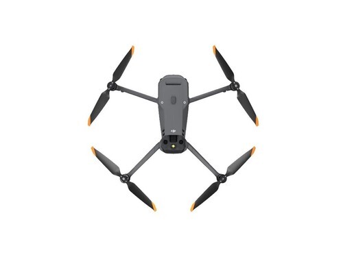
In the rapidly evolving world of technology, thermal drone camera technology emerges as a standout advancement, offering unparalleled insights from the skies. These cameras, equipped with thermal sensors, provide unique advantages, pushing the boundaries of aerial imaging.
Understanding Thermal Drone Camera Technology
Thermal drone cameras work by detecting heat emitted by objects on the ground. This technology allows drones to capture precise images based on temperature differences rather than visible light. Within industries like agriculture, construction, and emergency services, this feature opens a new realm of possibilities.
Applications of Thermal Drones
For farmers, thermal drone cameras present a unique opportunity to monitor crops and assess plant health efficiently. By identifying areas with temperature variances, drones can highlight issues such as water stress or pest infestations, which might not be visible to the naked eye.
In the construction sector, thermal imaging helps in identifying heat loss in buildings, enabling energy efficiency audits. These cameras easily detect areas of insulation failure and structural shortfalls.
Emergency Services and Public Safety
Thermal drone camera technology is invaluable in search and rescue missions, offering the ability to detect body heat even in challenging conditions. It significantly improves the chances of locating missing persons in remote or hazardous areas, regardless of lighting conditions. Additionally, these drones aid firefighters in assessing and battling fires, providing clear images through smoke and allowing for strategic planning.
Advanced Features and Functionalities
Today’s thermal drones come packed with advanced features such as high-resolution sensors, real-time transmission, and GPS integration. These functions enhance the operational capabilities of drones, providing real-time and highly accurate data. Some models even offer autonomous flight modes and extended flight times, allowing them to cover expansive areas without manual control.
- High Resolution: Improved sensors capture detailed thermal images, facilitating precise analysis.
- Real-Time Data: Instantaneous data transmission allows users to make informed decisions quickly.
- Autonomous Flight: GPS-assisted technology provides autonomous navigation for efficient coverage.

Moreover, with ever-evolving artificial intelligence integration, thermal drones are becoming more efficient in analyzing data and offering actionable insights automatically, improving workflow efficiency.
Challenges and Future Prospects
Despite their numerous benefits, operating thermal drone cameras requires understanding their limitations. For instance, interpreting thermal images necessitates specific expertise as readings can be influenced by weather conditions. Additionally, there are regulatory considerations, as drone flights are subject to aviation laws.
The future looks promising for thermal drone camera technology. With continuous advancements and decreasing costs, these cameras are expected to become more accessible to various sectors beyond their current applications. Furthermore, research and development into enhanced sensor technology mean we can anticipate even more sophisticated and robust solutions in the near future.
Frequently Asked Questions
- Can thermal drones operate at night?
Yes, thermal drones can effectively operate at night as they do not rely on visible light but on the infrared radiation emitted by objects.
- Are thermal drone images affected by weather?
Weather can influence thermal image readings as factors like rain or wind can impact temperature readings. Thus, pilots must consider weather forecasts before flights.
- How far can thermal drones fly?
Thermal drone range varies based on model and regulations. Typically, they have a range of several kilometers, but always ensure compliance with local laws regarding drone operations.