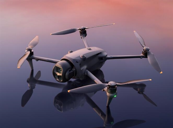
Revolutionizing Terrain Mapping with Drone Lidar Technology
In recent years, the advent of drone with lidar technology has revolutionized the industry of terrain mapping. Combining aerial drone capabilities with the precision of lidar (Light Detection and Ranging) sensors, this technology provides a new dimension of data accuracy, enhancing geographical reconnaissance and environmental monitoring.
Drones equipped with lidar sensors offer high-resolution data that was previously unattainable in traditional mapping techniques. The lidar emits rapid laser pulses towards the ground; these pulses bounce back to the sensor, measuring distances and creating a detailed 3D representation of the surveyed area. This method significantly increases the speed and quality of data collection in geospatial analysis and is vital for applications ranging from urban planning to forestry management.
Applications of Lidar in Drones
The integration of lidar technology in drones has opened doors to numerous applications. In urban planning, drones with lidar can efficiently capture current data about city landscapes and infrastructures, facilitating informed decision-making processes. Forest managers use this technology to assess biomass, monitor health, and plan sustainable interventions. Archaeologists benefit from lidar-equipped drones to penetrate dense vegetation, uncovering hidden monuments and ancient sites while mariners leverage these capabilities in coastal studies and flood modeling.
Surveying and construction industries are progressively adopting drones equipped with lidar to deliver precise measurements and identify potential structural challenges. Lidar technology is instrumental in creating digital elevation models (DEMs), which are essential for safe infrastructure development.
Technical Advantages of Drone-Based Lidar
Drone lidar systems provide unmatched precision and flexibility. They can navigate difficult terrains, improving data collection in places traditional methods might struggle. The ability to map large areas swiftly reduces time and cost, offering a practical solution for multi-disciplinary projects. Additionally, drones with lidar mitigate human error, enhance safety by minimizing personnel exposure to hazardous environments, and boast easy deployment with minimal logistical challenges.
Challenges and Considerations
Despite its advantages, drone lidar technology does face certain challenges. The initial investment is considerable, as high-quality lidar sensors and compatible drones demand significant capital. Training professionals to operate these technologically advanced systems and process large datasets remains crucial. Furthermore, weather conditions can impact data quality; thus, teams must plan accordingly to achieve desired precision.
FAQ: Understanding Drone Lidar Technology
Q1: How precise is lidar mapping with drones?
Lidar mapping offers remarkable precision, capable of centimeter-level accuracy depending on sensor quality. It’s ideal for detailed analyses required in tasks like infrastructure planning and environmental surveys.
Q2: Is lidar technology expensive?
Lidar systems require a significant investment upfront, which includes the cost of drones and sensors. However, the efficiency and data quality often result in long-term savings for industries reliant on frequent mapping.
Drones with lidar technology are not just a fleeting innovation but a cornerstone in the future of mapping, promising unparalleled precision, efficiency, and versatility across industries.